We use cookies to make your experience better. To comply with the new e-Privacy directive, we need to ask for your consent to set the cookies. Learn more
Germany Classic Map Tubed
Reference Maps
£24.95
In Stock
Usually dispatched within 24 hrs. Free delivery to UK for orders £25 and over
| Cordee Code: | NG0667 |
|---|---|
| Page Size: | 590 x 760 mm |
| No of Pages: | 1 |
| Publisher: | National Geographic Maps |
| ISBN13: | 9780792249672 |
| Weight: | 620g |
| Product Type: | Others |
| Countries: | Germany |
Dimensions: H77cm x W60cm
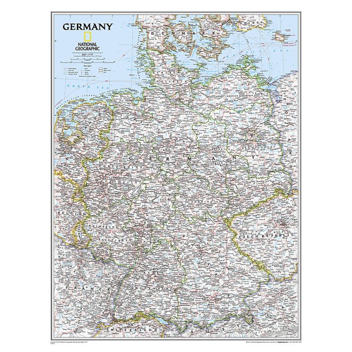
Germany on a wall map, paper version, from the National Geographic Society in their traditional classic style with a light base and country or internal state boundaries in colour. The map presents the division of Germany into individual states, showing their names in their English versions, e.g. Mecklenburg-Western Pomerania and not Mecklenburg-Vorpommern, or Rhineland-Palatinate and not Rheinland-Pfalz. Where appropriate, names of cities are shown in German first with the English equivalent in brackets: Koln (Cologne). Names of geographical features are given only in their German versions, e.g. Schwarzwald and not Black Forest, Donau and not Danube, etc. The map shows the network of main roads and railways, international airports and ferry routes on the Baltic and the North Sea. Topography is indicated by light relief shading, with spot heights and graphics for swamp areas. Latitude and longitude lines are drawn at 1? intervals.
Germany on a wall map, paper version, from the National Geographic Society in their traditional classic style with a light base and country or internal state boundaries in colour. The map presents the division of Germany into individual states, showing their names in their English versions, e.g. Mecklenburg-Western Pomerania and not Mecklenburg-Vorpommern, or Rhineland-Palatinate and not Rheinland-Pfalz. Where appropriate, names of cities are shown in German first with the English equivalent in brackets: Koln (Cologne). Names of geographical features are given only in their German versions, e.g. Schwarzwald and not Black Forest, Donau and not Danube, etc. The map shows the network of main roads and railways, international airports and ferry routes on the Baltic and the North Sea. Topography is indicated by light relief shading, with spot heights and graphics for swamp areas. Latitude and longitude lines are drawn at 1? intervals.