We use cookies to make your experience better. To comply with the new e-Privacy directive, we need to ask for your consent to set the cookies. Learn more
France, Belgium, and The Netherlands Classic Map Tubed
Reference Maps
£16.95
Temp Out Of Stock
| Cordee Code: | NG0665 |
|---|---|
| Page Size: | 590 x 760 mm |
| No of Pages: | 1 |
| Publisher: | National Geographic Maps |
| ISBN13: | 9780792249658 |
| Weight: | 620g |
| Product Type: | Others |
Dimensions: H77cm x W60cm
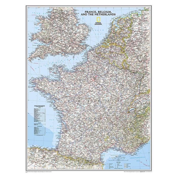
France with the Benelux counties at 1:1,953,000 on a wall map - paper version, from the National Geographic Society presented in their traditional classic style, with a light base and country boundaries in contrasting colours. In France the map shows the division of the country into regions, with a list of their names and regional capitals (curiously, Corsica is not included on the map - what would Napoleon think of that?). The map also provides plenty of names of both geographical features (Pyrenees, Cevennes, etc) and the country's traditional historical regions (Gascony, Maine, Bourbonais, etc). National parks are highlighted. Within Belgium the map indicates the division into Flanders, Wallonia and the Brussels Region and in the Netherlands boundaries of the country's administrative provinces are marked. Topography is shown by relief shading and within the Netherlands the areas below the sea level are also indicated. The map shows the network of main road and rail connections, local airports, as well as ferry links. Latitude and longitude lines are drawn at 1? intervals.
France with the Benelux counties at 1:1,953,000 on a wall map - paper version, from the National Geographic Society presented in their traditional classic style, with a light base and country boundaries in contrasting colours. In France the map shows the division of the country into regions, with a list of their names and regional capitals (curiously, Corsica is not included on the map - what would Napoleon think of that?). The map also provides plenty of names of both geographical features (Pyrenees, Cevennes, etc) and the country's traditional historical regions (Gascony, Maine, Bourbonais, etc). National parks are highlighted. Within Belgium the map indicates the division into Flanders, Wallonia and the Brussels Region and in the Netherlands boundaries of the country's administrative provinces are marked. Topography is shown by relief shading and within the Netherlands the areas below the sea level are also indicated. The map shows the network of main road and rail connections, local airports, as well as ferry links. Latitude and longitude lines are drawn at 1? intervals.