We use cookies to make your experience better. To comply with the new e-Privacy directive, we need to ask for your consent to set the cookies. Learn more
Everest Satellite Map
£25.00
In Stock
Usually dispatched within 24 hrs. Free delivery to UK for orders £25 and over
| Cordee Code: | CMW503 |
|---|---|
| Publisher: | Topkart |
| ISBN13: | 9788392147107 |
| Author: | P.M.A. - Geosystems |
| Language: | English |
| Published Date: | September 2005 |
| Weight: | 80g |
| Product Type: | Map |
| Countries: | China |
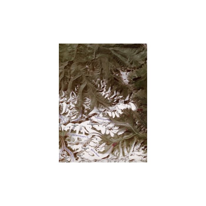
Satellite image map, scale 1:100 000
Available flat only, size 900 x 1300 mmThe region covered by this map is the largest collection of outstanding Himalayan peaks. Includes four 8,000m peaks - Everest, Lhotse, Cho Oyu and Makalu as well as a number of beautiful and difficult peaks such as Gauri Shankar, Ama Dablam, Nuptse and Gyachung Kang.Image shows section of map only*** Also available laminated as a special order. ?35.00 ***
Available flat only, size 900 x 1300 mmThe region covered by this map is the largest collection of outstanding Himalayan peaks. Includes four 8,000m peaks - Everest, Lhotse, Cho Oyu and Makalu as well as a number of beautiful and difficult peaks such as Gauri Shankar, Ama Dablam, Nuptse and Gyachung Kang.Image shows section of map only*** Also available laminated as a special order. ?35.00 ***