We use cookies to make your experience better. To comply with the new e-Privacy directive, we need to ask for your consent to set the cookies. Learn more
England and Wales Executive Map Tubed
Reference Maps
£16.95
Temp Out Of Stock
| Cordee Code: | NG0655 |
|---|---|
| Page Size: | 750 x 900 mm |
| No of Pages: | 1 |
| Publisher: | National Geographic Maps |
| ISBN13: | 9781597754903 |
| Weight: | 620g |
| Product Type: | Others |
| Countries: | United Kingdom |
Dimensions: H91cm x W76cm
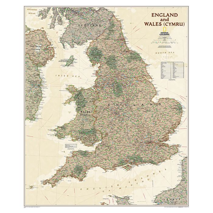
England and Wales NGS Executive Style Wall Map from the National Geographic, paper version, designed to present current information in colouring reminiscent of antique maps, with shades of beige and brown. The map presents the division of the two countries into counties and unitary authorities on a base map with subtle, light relief shading to indicate the topography, names of main mountain ranges, valleys and other geographical features, plus peak heights both in metres and feet. National parks are prominently highlighted. Road network is shown with numbers of the M and A routes, railway lines and ferry connections are included, and airports with schedules services are marked. Within Wales names of counties and main cities are also shown in Welsh, and Manx names are given on the Isle of Man. Latitude and longitude lines are drawn at 1? intervals.
England and Wales NGS Executive Style Wall Map from the National Geographic, paper version, designed to present current information in colouring reminiscent of antique maps, with shades of beige and brown. The map presents the division of the two countries into counties and unitary authorities on a base map with subtle, light relief shading to indicate the topography, names of main mountain ranges, valleys and other geographical features, plus peak heights both in metres and feet. National parks are prominently highlighted. Road network is shown with numbers of the M and A routes, railway lines and ferry connections are included, and airports with schedules services are marked. Within Wales names of counties and main cities are also shown in Welsh, and Manx names are given on the Isle of Man. Latitude and longitude lines are drawn at 1? intervals.