We use cookies to make your experience better. To comply with the new e-Privacy directive, we need to ask for your consent to set the cookies. Learn more
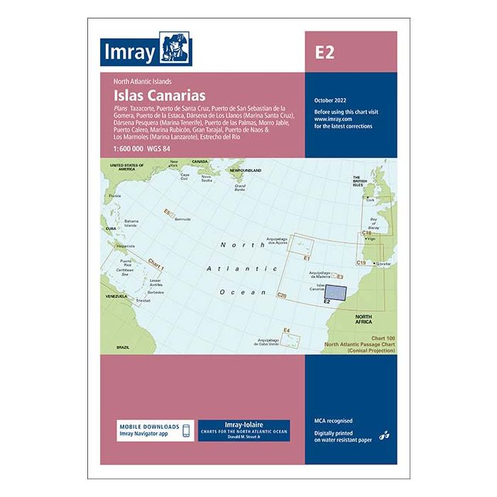
E2 Islas Canarias
£23.95
In Stock
Usually dispatched within 24 hrs. Free delivery to UK for orders £25 and over
| Cordee Code: | IM0229 |
|---|---|
| Page Size: | 210 x 297 mm |
| No of Pages: | 2 |
| Publisher: | Fb Imray Laurie Norie And Wilson |
| ISBN13: | 9781786794284 |
| Binding: | Sheet Map (folded) |
| Weight: | 180g |
| Product Type: | Map |
Plans included: Tazacorte (1:10 000) Puerto de Santa Cruz (1:12 500) Puerto de la Estaca (1:7500) Puerto de San Sebastian de la Gomera (1:10 000) D?rsena de Los Llanos (Marina Santa Cruz) (1:17 500) D?rsena Pesquera (Marina Tenerife) (1:17 500) Puerto de las Palmas (1:30 000) Morro Jable (1:12 500) Gran Trajal (1:10 000) Marina Rubic?n (1:25 000) Puerto Calero (1:15 000) Puerto de Naos & Los Marmoles (Marina Lanzarote) (1:12 500) Estrecho del R?o (1:50 000) Imray-Iolaire charts for Atlantic Islands are widely acknowledged as the best available for the cruising sailor. They combine the latest official survey Digital with first-hand information gathered over 60 years of research by Don Street Jr and his wide network of contributors. Like all Imray charts, they are printed on water resistant Pretex paper for durability, and they include many anchorages, facilities and inlets not included on official charts. This edition includes the latest official Digital combined with additional information sourced from Imray's network to make it ideal for small craft. It includes the latest official bathymetric surveys. The finished harbour works at Puerto de Naos & Los Marmoles and Playa Blanca (Lanzarote) are included. There has been general updating throughout.