We use cookies to make your experience better. To comply with the new e-Privacy directive, we need to ask for your consent to set the cookies. Learn more
Diablerets 1285
1:25 000
£12.99
Temp Out Of Stock
Map No. 1285, Les Diablerets, in the topographic survey of Switzerland at 1:25,000 from Swisstopo, with coverage extending from Leysin, the resort of Les Diablerets and Col du Pillon in the north to Bex in the south-western corner of the map.
| Cordee Code: | CMZ095 |
|---|---|
| Page Size: | 130 x 190 mm |
| No of Pages: | 1 |
| Publisher: | Swisstopo |
| ISBN13: | 9783302012858 |
| Author: | Swisstopo |
| Language: | English |
| Published Date: | April 2002 |
| Binding: | Sheet Map (folded) |
| Weight: | 50g |
| Product Type: | Map |
| Countries: | Switzerland |
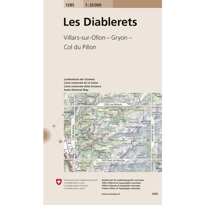
Map No. 1285, Les Diablerets, in the topographic survey of Switzerland at 1:25,000 from Swisstopo, with coverage extending from Leysin, the resort of Les Diablerets and Col du Pillon in the north to Bex in the south-western corner of the map.
Swiss topographic survey at 1:25,000 covers the whole country on 247 small format sheets, with special larger maps published for popular regions including some titles now available in hiking versions. Highly regarded for their superb use of graphic relief and hill shading, the maps give an almost 3-D picture of Switzerland's mountainous terrain. Contours are at 10 m intervals, with 20m intervals in the mountainous areas. All the maps have a 1-km grid for Swiss national coordinates (datum CH 1903).
Swiss topographic survey at 1:25,000 covers the whole country on 247 small format sheets, with special larger maps published for popular regions including some titles now available in hiking versions. Highly regarded for their superb use of graphic relief and hill shading, the maps give an almost 3-D picture of Switzerland's mountainous terrain. Contours are at 10 m intervals, with 20m intervals in the mountainous areas. All the maps have a 1-km grid for Swiss national coordinates (datum CH 1903).