We use cookies to make your experience better. To comply with the new e-Privacy directive, we need to ask for your consent to set the cookies. Learn more

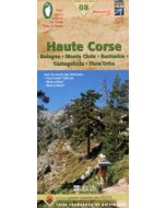
Corse le GR20 Pocket Map
FFRandonne map
£8.99
In Stock
Usually dispatched within 24 hrs. Free delivery to UK for orders £25 and over
Pocket map for the GR20 (Corsica) at 1:50,000.The whole of the GR20 on one pocket sized light weight map. Tourist information and outdoor activities are marked on the map, GR hiking trails are all highlighted, Road and rail networks are also shown and it is compatible with GPS systems.
| Cordee Code: | CMR069 |
|---|---|
| Publisher: | Editions Glenat |
| ISBN13: | 9782344000434 |
| Scale: | 1:50 000 |
| Author: | Libris |
| Published Date: | March 2014 |
| Edition: | 1st, March 2014 |
| Binding: | Sheet Map (folded) |
| Weight: | 35g |
| Product Type: | Map |
| Countries: | France |
Pocket map for the GR20 (Corsica) at 1:50,000.
The whole of the GR20 on one pocket sized light weight map. Tourist information and outdoor activities are marked on the map, GR hiking trails are all highlighted, Road and rail networks are also shown and it is compatible with GPS systems.
The whole of the GR20 on one pocket sized light weight map. Tourist information and outdoor activities are marked on the map, GR hiking trails are all highlighted, Road and rail networks are also shown and it is compatible with GPS systems.