We use cookies to make your experience better. To comply with the new e-Privacy directive, we need to ask for your consent to set the cookies. Learn more
Colorado Map Tubed
Reference Maps
£24.95
In Stock
Usually dispatched within 24 hrs. Free delivery to UK for orders £25 and over
| Cordee Code: | NG0636 |
|---|---|
| Page Size: | 1030 x 770 mm |
| No of Pages: | 1 |
| Publisher: | National Geographic Maps |
| ISBN13: | 9781597752343 |
| Weight: | 350g |
| Product Type: | Others |
Dimensions: H77cm x W103cm
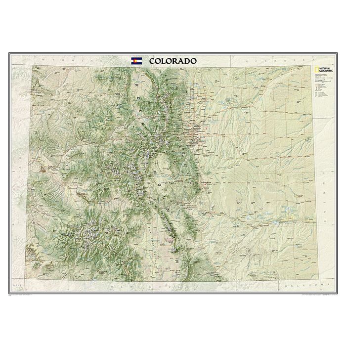
The spectacular topography of the Centennial State is expertly rendered on National Geographic's wall map of Colorado. Part of the growing series of State Wall Maps, this map depicts Colorado's diverse terrain and vegetation in remarkable detail. Mountain ranges, prominent peaks, major lakes, rivers, and reservoirs, and other geographic features are highlighted. In addition to hundreds of place names, this map includes the precise locations of cities, major roadways and railways, airports, military installations, federal and state parks, and protected areas. Prominent recreation features such as the Colorado Trail, Continental Divide Trail, and ski areas are also noted. This striking map would be an attractive addition to any study or office.
The spectacular topography of the Centennial State is expertly rendered on National Geographic's wall map of Colorado. Part of the growing series of State Wall Maps, this map depicts Colorado's diverse terrain and vegetation in remarkable detail. Mountain ranges, prominent peaks, major lakes, rivers, and reservoirs, and other geographic features are highlighted. In addition to hundreds of place names, this map includes the precise locations of cities, major roadways and railways, airports, military installations, federal and state parks, and protected areas. Prominent recreation features such as the Colorado Trail, Continental Divide Trail, and ski areas are also noted. This striking map would be an attractive addition to any study or office.