We use cookies to make your experience better. To comply with the new e-Privacy directive, we need to ask for your consent to set the cookies. Learn more
Carinthia East Tyrol, Walking map Set 1:50000
£149.90
Temp Out Of Stock
| Cordee Code: | FB0901 |
|---|---|
| Page Size: | 120 x 215 mm |
| Publisher: | Freytag & Berndt |
| ISBN13: | 9783707919035 |
| Published Date: | September 2020 |
| Binding: | Sheet Map (folded) |
| Product Type: | Map |
| Countries: | Austria |
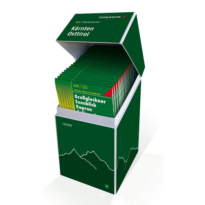
This unique hiking map box contains a set with all 20 hiking maps for Carinthia and East Tyrol on a scale of 1:50,000! It is ideal for frequent hikers who want to explore every bit of nature on their tours! Thanks to the detailed digital cartography and the precise scales, freytag & berndt hiking maps are ideal companions for hiking, mountaineering, cycling and ski tours. They are of course also GPS compatible. Contents: WK 120 Gro?glockner WK 123 Matrei WK 141 Julian Alps WK 181 Kals WK 182 Lienz Dolomites WK 202 Radst?dter Tauern WK 211 Zirbitzkogel Nature Park WK 221 Liesertal WK 222 Bad Kleinkirchheim WK 223 Carnic Alps WK 224 Faaker See WK 225 M?lltal WK 231 Central Carinthia WK 233 W?rthersee WK 237 Saualpe WK 238 Southern Carinthia WK 411 Styrian wine country