We use cookies to make your experience better. To comply with the new e-Privacy directive, we need to ask for your consent to set the cookies. Learn more
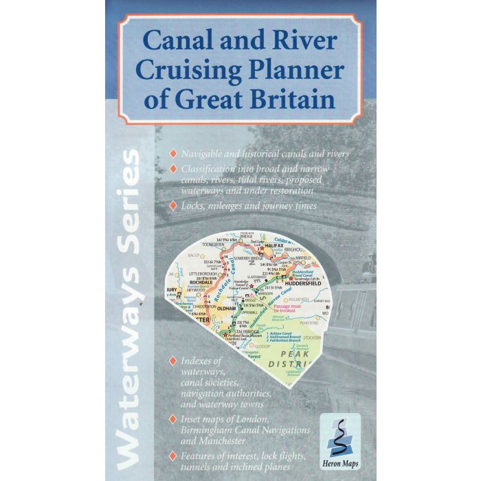
Canal and River Cruising Planner of Great Britain
£5.99
Temp Out Of Stock
| Cordee Code: | CTK717 |
|---|---|
| Publisher: | Heron Maps Consignment |
| ISBN13: | 9781908851260 |
| Author: | Heron Maps |
| Published Date: | January 2018 |
| Edition: | 1st ed, Jan 2018 |
| Binding: | Sheet Map (folded) |
| Weight: | 80g |
| Product Type: | Map |
| Countries: | United Kingdom |
This cruise planner is the perfect companion to our individual waterways maps showing the entire waterway network of Great Britain.
A double sided folded map of Great Britain's entire waterway network at 1:660,000 scale, ideal for cruise planning. It shows all navigable canals and rivers clearly distinguishing between broad and narrow canals and tidal and non-tidal rivers. There are inset maps of Birmingham Canal Navigations, London and Manchester shown at 1:150,000 scale.
A double sided folded map of Great Britain's entire waterway network at 1:660,000 scale, ideal for cruise planning. It shows all navigable canals and rivers clearly distinguishing between broad and narrow canals and tidal and non-tidal rivers. There are inset maps of Birmingham Canal Navigations, London and Manchester shown at 1:150,000 scale.