We use cookies to make your experience better. To comply with the new e-Privacy directive, we need to ask for your consent to set the cookies. Learn more
Canada Classic Map Laminated
Reference Maps
£39.95
In Stock
Usually dispatched within 24 hrs. Free delivery to UK for orders £25 and over
| Cordee Code: | NG0621 |
|---|---|
| Page Size: | 950 x 800 mm |
| No of Pages: | 1 |
| Publisher: | National Geographic Maps |
| ISBN13: | 9781597753555 |
| Weight: | 500g |
| Product Type: | Others |
| Countries: | Canada |
Dimensions: H81cm x W97cm
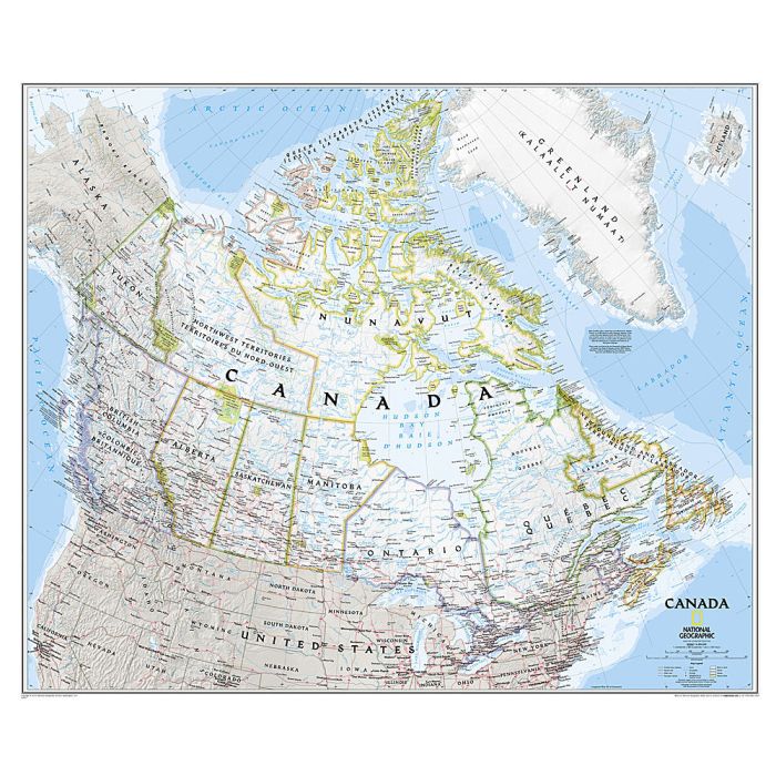
The traditional classic presentation with pale base and provincial boundaries shown in contrasting colours. The base map has relief shading to show the Rocky Mountains, plus plenty of names of geographical features: individual mountain chains, peaks, rivers and lakes, bays and sea channels, etc. Along the coast the extent of winter sea ice is marked. National Parks are highlighted. The map shows the network of main roads and railways and indicates local airports with regular air or sea plane service, particularly in the more remote parts of the country. Also marked are oil fields and pipelines. Latitude and longitude lines are drawn at 5 degrees.
The traditional classic presentation with pale base and provincial boundaries shown in contrasting colours. The base map has relief shading to show the Rocky Mountains, plus plenty of names of geographical features: individual mountain chains, peaks, rivers and lakes, bays and sea channels, etc. Along the coast the extent of winter sea ice is marked. National Parks are highlighted. The map shows the network of main roads and railways and indicates local airports with regular air or sea plane service, particularly in the more remote parts of the country. Also marked are oil fields and pipelines. Latitude and longitude lines are drawn at 5 degrees.