We use cookies to make your experience better. To comply with the new e-Privacy directive, we need to ask for your consent to set the cookies. Learn more
California Map Tubed
Reference Maps
£24.95
In Stock
Usually dispatched within 24 hrs. Free delivery to UK for orders £25 and over
| Cordee Code: | NG0620 |
|---|---|
| Page Size: | 840 x 1010 mm |
| No of Pages: | 1 |
| Publisher: | National Geographic Maps |
| ISBN13: | 9781597752053 |
| Weight: | 350g |
| Product Type: | Others |
Dimensions: H103cm x 85cm
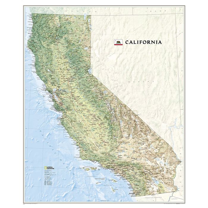
Physical wall map of California, *paper version*, from the National Geographic Society showing the state's topography by relief shading and colouring, with peak heights in feet. The map gives plenty of names of mountain ranges, peaks, valleys, etc. and highlights national parks and other protected areas. Principal roads and railways, as well as airports with passenger services are marked, plus several military establishments. The map has latitude and longitude lines at intervals of 1?.
Physical wall map of California, *paper version*, from the National Geographic Society showing the state's topography by relief shading and colouring, with peak heights in feet. The map gives plenty of names of mountain ranges, peaks, valleys, etc. and highlights national parks and other protected areas. Principal roads and railways, as well as airports with passenger services are marked, plus several military establishments. The map has latitude and longitude lines at intervals of 1?.