We use cookies to make your experience better. To comply with the new e-Privacy directive, we need to ask for your consent to set the cookies. Learn more
Britain and Ireland Classic Map Laminated
Reference Maps
£27.99
Temp Out Of Stock
| Cordee Code: | NG0616 |
|---|---|
| Page Size: | 590 x 760 mm |
| No of Pages: | 1 |
| Publisher: | National Geographic Wall Maps |
| ISBN13: | 9780792250234 |
| Weight: | 620g |
| Product Type: | Others |
Dimensions: H77cm x W60cm
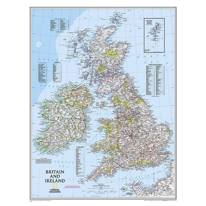
National Geographic's Classic political map of Britain and Ireland is both an attractive addition to any study or classroom and an informative tool for exploring these fascinating countries. The map features thousands of place names, major highways and roads, airports, ferry routes, bodies of water, and more. Handy indexes make it easy to identify the counties, districts, council areas, unitary authorities, and metropolitan districts of Ireland, Northern Ireland, Scotland, Wales, and England. An inset provides detail of the Shetland Islands. National parks are clearly indicated in green vignettes, and shaded relief reveals the interesting and varied topography of these island nations.
English and Gaelic (Irish) share official status per the Republic of Ireland's constitution, so place names are rendered in both. In the Gaeltachtl, or predominantly Irish-speaking regions, only Irish place-names have official status and are used on signposts. These districts are found within the counties of Cork, Donegal, Galway, Kerry, Mayo, Meath, and Waterford.
The map is encapsulated in heavy-duty 1.6 mil laminate which makes the paper much more durable and resistant to the swelling and shrinking caused by changes in humidity. Laminated maps can be framed without the need for glass, so the frames can be much lighter and less expensive.