We use cookies to make your experience better. To comply with the new e-Privacy directive, we need to ask for your consent to set the cookies. Learn more
Brazil Executive Map Laminated
Reference Maps
£49.95
In Stock
Usually dispatched within 24 hrs. Free delivery to UK for orders £25 and over
| Cordee Code: | NG0614 |
|---|---|
| Publisher: | National Geographic Maps |
| ISBN13: | 9781597754354 |
| Binding: | Oversized Tube |
| Weight: | 500g |
| Product Type: | Others |
| Countries: | Brazil |
103cm x 95cm
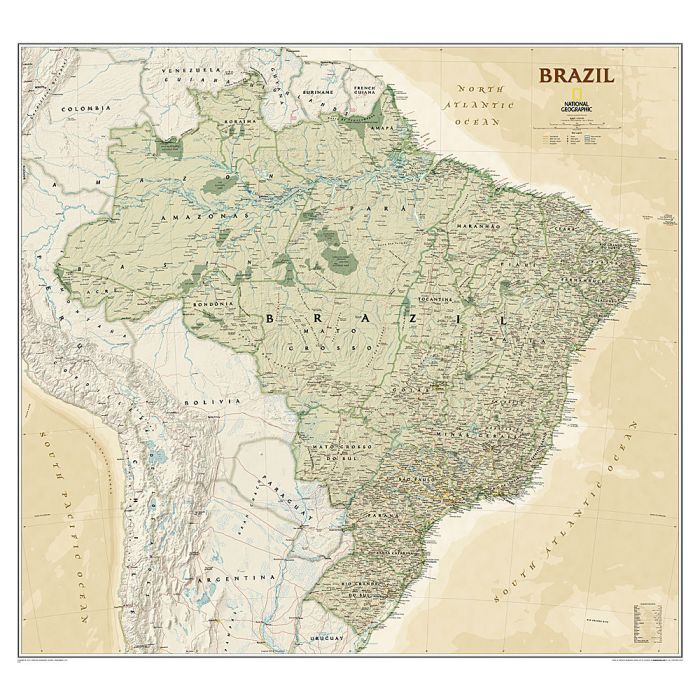
Expertly researched and designed, National Geographic's Brazil Exective wall map is fittingly one of the largest maps available of the largest country in South America, and the fifth largest in the World. It shows the entire country in exceptional detail, including Brazil's 26 states and 1 federal district, plus the coastal islands that make up Fernando de Noronha National Marine Park, Abrolhos National Park, and Arquipelago dos Abrolhos.
The map shows over 1,000 named places including state capitals, primary and secondary towns, political boundaries, important infrastructure, and all key landforms. Brazil's national parks are clearly highlighted and labeled, as is the country's rich network of rivers that feed the Amazon?the world's second longest river.
The map is encapsulated in heavy-duty 1.6 mil laminate which makes the paper much more durable and resistant to the swelling and shrinking caused by changes in humidity. Laminated maps can be framed without the need for glass, so the frames can be much lighter and less expensive.
Please note that these maps come rolled in a tube and are oversized. As such they attract an extra carriage charge of ?10 (non-trade customers only).