We use cookies to make your experience better. To comply with the new e-Privacy directive, we need to ask for your consent to set the cookies. Learn more
Blue Ridge Parkway Recreation Map
£9.95
In Stock
Usually dispatched within 24 hrs. Free delivery to UK for orders £25 and over
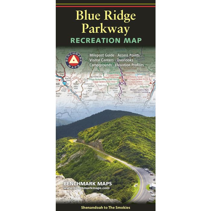
Running 469 miles through the mountains of Virginia and North Carolina, the Blue Ridge Parkway connects Shenandoah National Park in the north to Great Smoky Mountains National Park in the south.
| Cordee Code: | CMA617 |
|---|---|
| Page Size: | 100 x 230 mm |
| No of Pages: | 2 |
| Publisher: | Benchmark Maps |
| ISBN13: | 9780783499734 |
| Scale: | 1:360,000 |
| Published Date: | December 2024 |
| Edition: | December 2024 |
| Binding: | Sheet Map (folded) |
| Weight: | 60g |
| Product Type: | Map |
The route is renowned for its many scenic overlooks, hiking trails, historical sites, and cultural landmarks, offering travelers a classic glimpse of the Appalachian Highlands. The map shows the northern & southern halves of the parkway on two sides, each with extensive public land and road detail. The Milepost Guides list 200 attractions by mile marker, with descriptions and map grid references. The Elevation Profiles show the many ups and downs along the parkway, a very helpful planning tool if pulling a trailer. This folded map was compiled from the Southern Appalachians Road & Recreation Atlas; a 144-page book that portrays the entrancing scenery and recreation potential of the entire region.