We use cookies to make your experience better. To comply with the new e-Privacy directive, we need to ask for your consent to set the cookies. Learn more
B31 Grenadines Middle Sheet
Bequia to Carriacou
£23.95
In Stock
Usually dispatched within 24 hrs. Free delivery to UK for orders £25 and over
| Cordee Code: | IM0050 |
|---|---|
| Page Size: | 210 x 297 mm |
| No of Pages: | 2 |
| Publisher: | Fb Imray Laurie Norie And Wilson |
| ISBN13: | 9781846237041 |
| Binding: | Sheet Map (folded) |
| Weight: | 180g |
| Product Type: | Map |
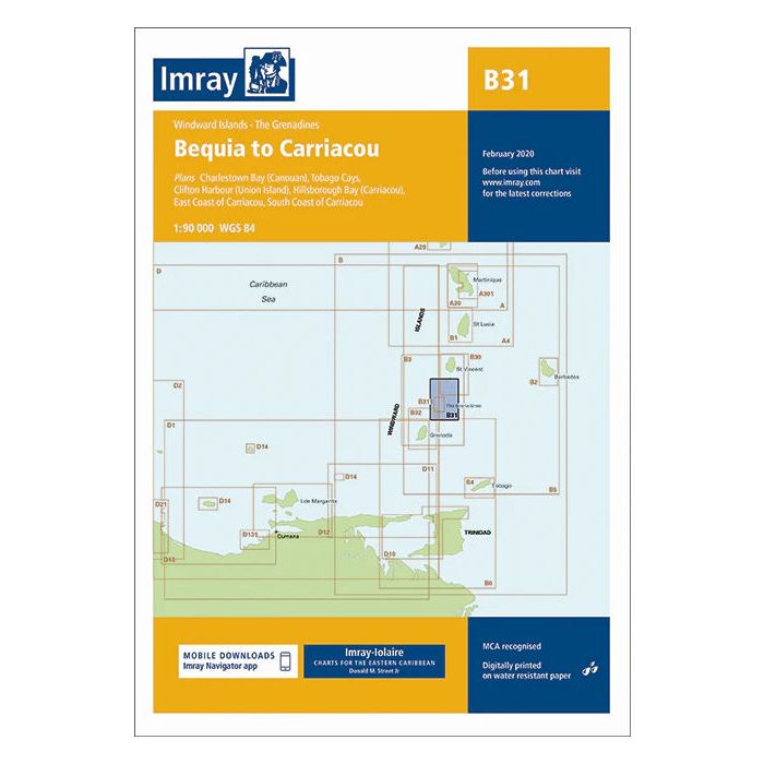
Imray-Iolaire charts for Caribbean are widely acknowledged as the best available for the cruising sailor. They combine the latest official survey Digital with first-hand information gathered over 60 years of research by Don Street Jr and his wide network of contributors. Like all Imray charts, they are printed on water resistant Pretex paper for durability, and they include many anchorages, facilities and inlets not included on official charts. Plans included: Charlestown Bay (Canouan) (1:20 000) Tobago Cays (1:30 000) Clifton Harbour (Union Island) (1:25 000) Hillsborough Bay (Carriacou) (1:35 000) East Coast of Carriacou (1:45 000) South Coast of Carriacou (1:50 000) For this edition the chart has been fully updated throughout. Two new plans have been added of the east and south coasts of Carriacou. These new plans display revised depths and anchorages in the waters around Carriacou.