We use cookies to make your experience better. To comply with the new e-Privacy directive, we need to ask for your consent to set the cookies. Learn more
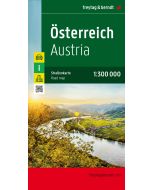
Austria, Road Atlas 1:200000
£15.90
Temp Out Of Stock
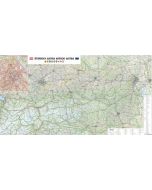
Austrian road atlas 1:200,000 offers a wealth of supplementary information, such as points of interest, campsites, and numerous city maps.
| Cordee Code: | FB1714 |
|---|---|
| Page Size: | 210 x 297 mm |
| No of Pages: | 176 |
| Publisher: | Freytag & Berndt |
| ISBN13: | 9783707920864 |
| Scale: | 1:200.000 |
| Author: | Freytag & Berndt |
| Published Date: | January 2025 |
| Edition: | 2025 |
| Binding: | Paperback |
| Weight: | 480g |
| Product Type: | Map |
| Countries: | Austria |
Car and motorcycle drivers particularly appreciate freytag & berndt's precise cartography for planning and orientation on the road.
Caravan and campervan owners will, of course, find all campsites and pitches in this Austrian road atlas.
Information about the Austrian road atlas:
-Scale 1:200,000
-Extended map section
-Tourist information
-Local directory with postal codes
-Planning map of Europe 1:3.5 million.
-City center maps with street index of Bregenz, Eisenstadt, Graz, Innsbruck, Klagenfurt, Linz, Salzburg, St. P?lten and Vienna.