We use cookies to make your experience better. To comply with the new e-Privacy directive, we need to ask for your consent to set the cookies. Learn more
Australia Classic Map Tubed
Reference Maps
£16.95
Temp Out Of Stock
| Cordee Code: | NG0609 |
|---|---|
| Page Size: | 770 x 690 mm |
| No of Pages: | 1 |
| Publisher: | National Geographic Maps |
| ISBN13: | 9780792280996 |
| Weight: | 620g |
| Product Type: | Others |
Dimensions: H69cm x W77cm
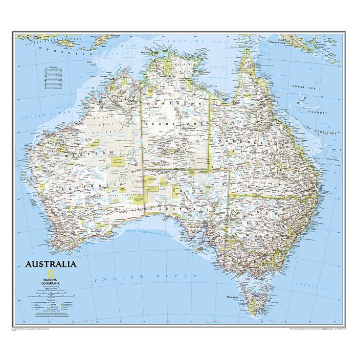
Presenting the country in the National Geographic Society's classic style: light base with relief shading and state boundaries in contrasting colours. The base map has relief shading to show the topography of the country, with further graphics to indicate deserts, swamps, salt flats, etc, and gives plenty of names of mountain ranges, deserts, rivers and lakes, coastal bays and other geographical features. The map also highlights a selection of Australia's numerous national parks or other protected areas and indicates boundaries of Aboriginal Lands. In addition to main road and rail connections main local airports are marked. Latitude and longitude lines are drawn at 4 intervals.
Presenting the country in the National Geographic Society's classic style: light base with relief shading and state boundaries in contrasting colours. The base map has relief shading to show the topography of the country, with further graphics to indicate deserts, swamps, salt flats, etc, and gives plenty of names of mountain ranges, deserts, rivers and lakes, coastal bays and other geographical features. The map also highlights a selection of Australia's numerous national parks or other protected areas and indicates boundaries of Aboriginal Lands. In addition to main road and rail connections main local airports are marked. Latitude and longitude lines are drawn at 4 intervals.