We use cookies to make your experience better. To comply with the new e-Privacy directive, we need to ask for your consent to set the cookies. Learn more
Around Annapurna NA504
1:100,000 trekking map
£14.99
In Stock
Usually dispatched within 24 hrs. Free delivery to UK for orders £25 and over
| Cordee Code: | CMW807 |
|---|---|
| Page Size: | 127 x 245 mm |
| No of Pages: | 1 |
| Publisher: | Nepa Publications |
| ISBN13: | 9789937783354 |
| Author: | Nepa Maps 1:100,000 |
| Published Date: | October 2023 |
| Edition: | October 2023 |
| Binding: | Sheet Map (folded) |
| Weight: | 60g |
| Product Type: | Map |
| Countries: | Nepal |
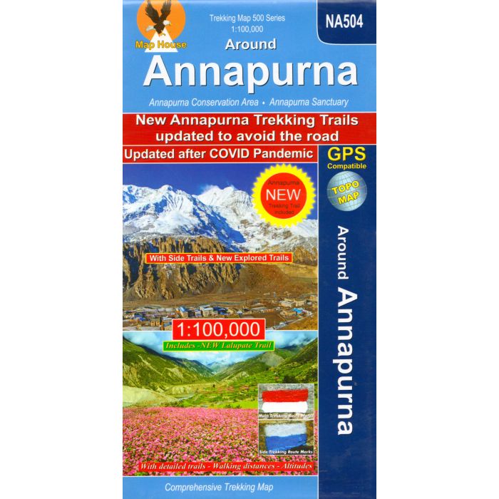
The whole of the Annapurna Circuit highlighted on a map at 1:100,000 from Nepa Maps, with alternative variants via the Tilicho Lakes or Naar, treks to the Machhapuchhre and South Annapurna Base Camps, climbing routes to the Chulu Peaks, Pisang Peak and Singu Chuli (Fluted Peak), etc. Coverage extends from Pohkara to Muktinath and Kagbeni in the north, and in the north east includes the route to Phugaon and the trek/climb to Himlung. Contours are at 80m intervals. The index lists settlements, peaks, passes and lakes. Margin ticks give latitude and longitude at 5? intervals. Additional information includes a profile of the route and tables showing the route and its variants in stage with altitudes in metres and feet, plus trekking times.