We use cookies to make your experience better. To comply with the new e-Privacy directive, we need to ask for your consent to set the cookies. Learn more
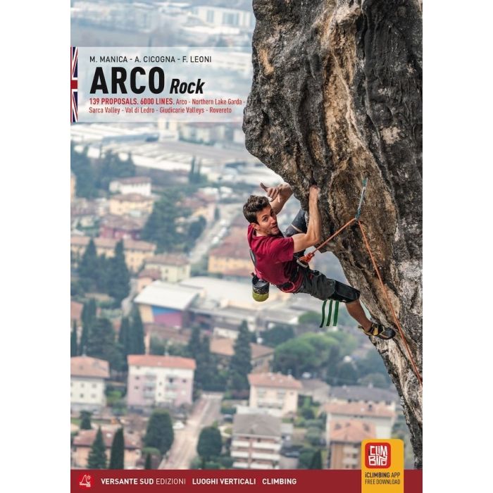
Arco Rock: Arco, Sarca Valley, Valle dei Laghi, Trento
Rovereto, Giudicarie Valeys, Val di Non
£39.95
Not Yet Published
This title has not yet been released. You may pre-order now and we will deliver it to you when it arrives.
Contact [email protected]
Contact [email protected]
Expected: 1st June 2026
| Cordee Code: | CCE848 |
|---|---|
| Page Size: | 152 x 210 mm |
| No of Pages: | 808 |
| Publisher: | Versante Sud |
| ISBN13: | 9788855472050 |
| Author: | Manica, Negretti & Cicogna |
| Published Date: | June 2026 |
| Edition: | 6th: June 2026 |
| Binding: | Paperback (flapped) |
| Illustrations: | topo diagrams & colour photos |
| Weight: | 945g |
| Geoarea: | Alps Southern Limestone (austria, Italy, And Slovenia) |
| Product Type: | Guide Books |
| Countries: | Italy |
This is the definitive rock climbing and sport climbing guidebook around Arco and the Sarche valley near Lake Garda, and the Giudicarie valley near Trento in Italy. The guidebook covers all the bolted sport routes in and around the Arco area, which features 139 different crags detailing more than 6,000 routes across all grades (F3?s to F9b) on limestone rock. This Arco Rock guidebook covers Arco, Sarca Valley, Valle del Laghi, Trento, Rovereto, Giudicarie Valleys, and Val di Non.
All the routes are shown on clear topo diagrams, along with route length and a brief description. For each crag there is a QR code for the location of the parking area, location map and a good description giving a general overview of the area and type of rock climbing to be found at each crag. Symbols are then used to indicate altitude, exposure to the sun, how good the bolting is, popularity, how good the parking is, the general beauty of the crag, and if it is child friendly, plus the total number of routes at the crag for each grade... English text throughout...
All the routes are shown on clear topo diagrams, along with route length and a brief description. For each crag there is a QR code for the location of the parking area, location map and a good description giving a general overview of the area and type of rock climbing to be found at each crag. Symbols are then used to indicate altitude, exposure to the sun, how good the bolting is, popularity, how good the parking is, the general beauty of the crag, and if it is child friendly, plus the total number of routes at the crag for each grade... English text throughout...