We use cookies to make your experience better. To comply with the new e-Privacy directive, we need to ask for your consent to set the cookies. Learn more
Antarctica Satellite Map Laminated
Reference Maps
£29.95
Temp Out Of Stock
| Cordee Code: | NG0599 |
|---|---|
| Page Size: | 780 x 510 mm |
| No of Pages: | 1 |
| Publisher: | National Geographic Maps |
| ISBN13: | 9780792250128 |
| Weight: | 350g |
| Product Type: | Others |
Dimensions: H51cm x W79cm
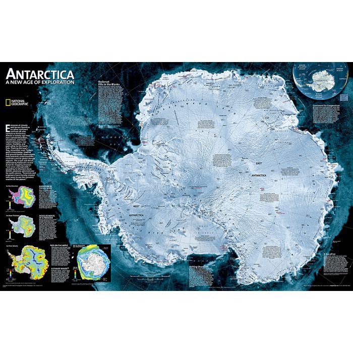
A wall map with a satellite image of Antarctica, with hill-shading to present the terrain and many peaks, glaciers and research stations. In 1997, in a joint project conducted by the Canadian Space Agency (CSA) and NASA, the satellite Radarsat I imaged the Antarctic in its entirety. The resulting data enabled researchers to fill in the gaps on existing maps. Annotated to briefly present topics such as ice sheet thickness, winds and ice flow velocity. Latitude and longitude lines are overprinted on the map. Projection: Azimuthal Equidistant.
A wall map with a satellite image of Antarctica, with hill-shading to present the terrain and many peaks, glaciers and research stations. In 1997, in a joint project conducted by the Canadian Space Agency (CSA) and NASA, the satellite Radarsat I imaged the Antarctic in its entirety. The resulting data enabled researchers to fill in the gaps on existing maps. Annotated to briefly present topics such as ice sheet thickness, winds and ice flow velocity. Latitude and longitude lines are overprinted on the map. Projection: Azimuthal Equidistant.