We use cookies to make your experience better. To comply with the new e-Privacy directive, we need to ask for your consent to set the cookies. Learn more
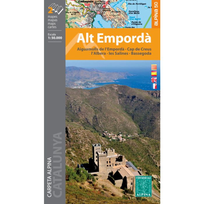
Alt Emporda 2 maps 1: 50 000
Aiguamolls de l'Emporda - Cap de Creus - l'Abera - les Salin
£14.00
In Stock
Usually dispatched within 24 hrs. Free delivery to UK for orders £25 and over
| Cordee Code: | CMM235 |
|---|---|
| Page Size: | 115 x 185 mm |
| Publisher: | Editorial Alpina |
| ISBN13: | 9788480907903 |
| Scale: | 1:50 000 |
| Published Date: | July 2020 |
| Edition: | 2019-20 |
| Binding: | Sheet Map (folded) |
| Weight: | 140g |
| Geoarea: | Pyrenees |
| Product Type: | Map |
| Countries: | Spain |
The Alt Emporda is a region of great contrasts of the northern Catalonia: the coast is combined perfectly with the mountain. The natural parks of the Aiguamolls de l'Emporda and Cap de Creus are two protected areas that contribute to the conservation of a territory rich and fragile at the same time.
Moreover, the massifs of Albera and Salines, are the last two exponents of the Pyrenees before fusing with the Mediterranean.
The map includes the entire network of Itinerannia footpaths, as well as long-distance trails that cross the region: GR 1, GR 11, GR 92, GR 2, GR 10 on the French side, and a section of the Camino de Santiago. It also includes the location of all hosting services, information points and items of interest.
-

-
 Paratge Natural dInteres Nacional de lAlbera 47 1:25,000Catalunya - Alt Emporada£14.95
CMM159
Temp Out Of Stock