We use cookies to make your experience better. To comply with the new e-Privacy directive, we need to ask for your consent to set the cookies. Learn more
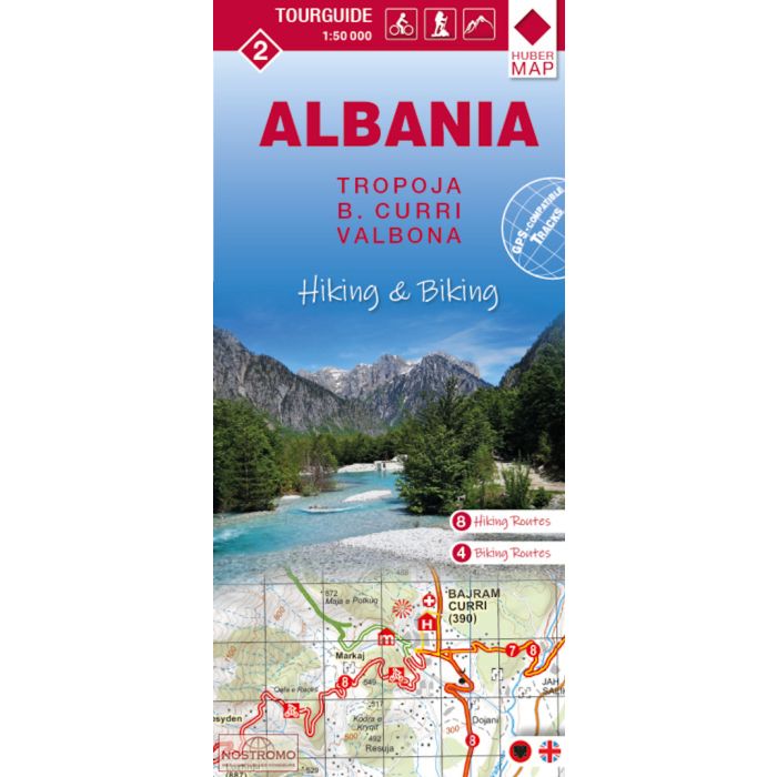
Albania Hiking and Biking Map 2
Tropoja, B.Curri, Valbona 1:50,000
£11.95
In Stock
Usually dispatched within 24 hrs. Free delivery to UK for orders £25 and over
Tropoja - B. Curri - Valbona area of northern Albania at 1:50,000 in a series of GPS compatible contoured maps from Huber Verlag showing hiking and cycling routes, climbing sites, tourist accommodation, etc, with detailed descriptions of recommended tours.
| Cordee Code: | CMY147 |
|---|---|
| Publisher: | Huber Kartographie & Verlag |
| ISBN13: | 9783943752601 |
| Scale: | 1:50 000 |
| Published Date: | September 2024 |
| Edition: | 2025 edition |
| Binding: | Sheet Map (folded) |
| Weight: | 80g |
| Product Type: | Map |
| Countries: | Albania |
Tropoja - B. Curri - Valbona area of northern Albania at 1:50,000 in a series of GPS compatible contoured maps from Huber Verlag showing hiking and cycling routes, climbing sites, tourist accommodation, etc, with detailed descriptions of recommended tours.
The map has contours at 50m intervals, with spot heights, graphic relief for exposed rocky areas and colouring showing woodlands. Recommended hiking and cycling routes are prominently marked and cross-referenced to descriptions on the reverse side. Interesting towns and villages are highlighted and symbols indicate hotels and other tourist accommodation, sites for climbing and/or kayaking, museums, archaeological remains, medical facilities, etc. The maps have a 1-km UTM grid.
On the reverse are detailed descriptions of the recommended hiking and cycling trails accompanied in some titles by route profiles. Map legend and all the text include English.