We use cookies to make your experience better. To comply with the new e-Privacy directive, we need to ask for your consent to set the cookies. Learn more
Africa Classic Map Tubed
Reference Maps
£16.95
Temp Out Of Stock
| Cordee Code: | NG0594 |
|---|---|
| Page Size: | 600 x 770 mm |
| No of Pages: | 1 |
| Publisher: | National Geographic Maps |
| ISBN13: | 9780792281030 |
| Weight: | 620g |
| Product Type: | Others |
Dimensions: H78cm x W61cm
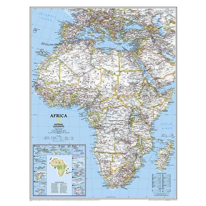
Coverage includes the whole of the Mediterranean Basin, extending north to London. Islands in the Atlantic and the Indian Ocean are included on a separate inset. The base map has relief shading to show the continent?s topography, with additional graphics indicating deserts, swamps, salt flats, etc. The map shows the names of the main geographic features such as mountain ranges, deserts, peaks etc. Heights are given in metres, except for Kilimanjaro, shown in both metres and feet. In the Congo basin many of the tributaries are named. Country boundaries are shown in contrasting colours. All place names are in English, except for selected cities such as Cairo, Tripoli or Algiers where the original names are shown first (El Quahira, etc) with the English equivalents in brackets. Where appropriate, administrative, legislative and judicial capital cities are indicated (e.g. Dar Es Salam/Dodoma, Johannesburg/Cape Town/Bloemfontein, etc). The map also shows the networks of main road and railway connections, airports, and oil fields with pipelines. Latitude and longitude lines are drawn at 5? degrees intervals. Also provided is a glossary of geographical terms and abbreviations used on the map. PLEASE NOTE: current edition still shows Sudan as one country. Somalia is shown as two separate countries: Somalia with a capital in Muqdisho/Mogadishu and in the north Somaliland. An annotating note provides an explanation of the current political and international status.
Coverage includes the whole of the Mediterranean Basin, extending north to London. Islands in the Atlantic and the Indian Ocean are included on a separate inset. The base map has relief shading to show the continent?s topography, with additional graphics indicating deserts, swamps, salt flats, etc. The map shows the names of the main geographic features such as mountain ranges, deserts, peaks etc. Heights are given in metres, except for Kilimanjaro, shown in both metres and feet. In the Congo basin many of the tributaries are named. Country boundaries are shown in contrasting colours. All place names are in English, except for selected cities such as Cairo, Tripoli or Algiers where the original names are shown first (El Quahira, etc) with the English equivalents in brackets. Where appropriate, administrative, legislative and judicial capital cities are indicated (e.g. Dar Es Salam/Dodoma, Johannesburg/Cape Town/Bloemfontein, etc). The map also shows the networks of main road and railway connections, airports, and oil fields with pipelines. Latitude and longitude lines are drawn at 5? degrees intervals. Also provided is a glossary of geographical terms and abbreviations used on the map. PLEASE NOTE: current edition still shows Sudan as one country. Somalia is shown as two separate countries: Somalia with a capital in Muqdisho/Mogadishu and in the north Somaliland. An annotating note provides an explanation of the current political and international status.