We use cookies to make your experience better. To comply with the new e-Privacy directive, we need to ask for your consent to set the cookies. Learn more
Africa Classic Map Enlarged and Tubed
Reference Maps
£29.95
In Stock
Usually dispatched within 24 hrs. Free delivery to UK for orders £25 and over
| Cordee Code: | NG0592 |
|---|---|
| Page Size: | 890 x 1160 mm |
| No of Pages: | 1 |
| Publisher: | National Geographic Maps |
| ISBN13: | 9780792281054 |
| Binding: | Oversized Tube |
| Weight: | 600g |
| Product Type: | Others |
Dimensions: H117cm x W91cm
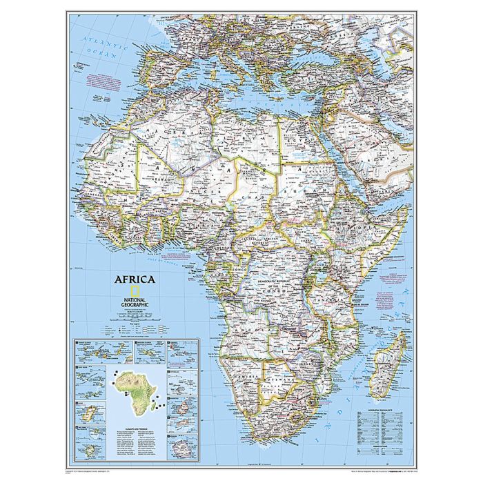
Expertly researched and designed, National Geographic's Africa Wall Map is the authoritative map of Africa by which other reference maps are measured.
Product Features:
Signature Classic style map with bright, easy to read color palette with blue oceans and colorful borders
Background shows mountain ranges and valleys in subtle shaded relief with mountain ranges labeled
Major water bodies including rivers, lakes, glaciers, oceans, seas, gulfs, bays, straits, and bathymetry
Clearly defined international boundaries, cities, islands, airports, and physical features.
Thousands of place names carefully and artfully placed to maintain legibility in heavily populated areas
Up-to-date international boundaries and territorial control reflect de facto status on the ground
Meticulously researched using multiple authoritative sources including the United Nations and policies of individual governments.
Accurate place names use a combination of conventional English names, official national names, and standard transliterations for non-Latin alphabets.
Major landforms including deserts, lava fields, swamps, dry salt lakes, intermittent lakes, salt deserts, and areas below sea level
Inset maps of the 10 island nations surrounding Africa and climate and terrain topographic map of the continent
Countries shown include: Algeria, Angola, Benin, Botswana, Burkina Faso, Burundi, Cameroon, Cape Verde, Central African Republic, Chad, Democratic Republic of the Congo, Republic of Congo, C?te d'Ivoire, Djibouti, Egypt, Equatorial Guinea, Eritrea, Ethiopia, Gabon, Gambia, Ghana, Guinea, Guinea-Bissau, Kenya, Liberia, Libya, Madagascar, Malawi, Mali, Mauritania, Morocco, Mozambique, Namibia, Niger, Nigeria, Rwanda, Senegal, Sierra Leone, Somalia, South Africa, Sudan, South Sudan, Tanzania, Togo, Tunisia, Uganda, Zambia, and Zimbabwe. The island nations shown are: Canary Islands, Madeira Islands, Comoros, Seychelles, Mauritius, Rodrigues, Reunion, Sao Tome and Principe, Bioko, and Cape Verde.
Enlarged maps provide an immersive experience in any home or office environment. The exceptional cartography is even easier to appreciate at the larger size. The map is packaged in a two inch diameter tube with a label showing a thumbnail of the map with dimensions and other pertinent information.
Please note that these maps come rolled in a tube and are oversized. As such they attract an extra carriage charge of ?10 (non-trade customers only).