We use cookies to make your experience better. To comply with the new e-Privacy directive, we need to ask for your consent to set the cookies. Read our privacy and security policy


Achill and Corraun detailed maps 1:25,000
including Clare Island
£14.99
Temp Out Of Stock
| Cordee Code: | CME267 |
|---|---|
| Page Size: | 125 x 205 mm |
| Publisher: | Eastwest Mapping |
| ISBN13: | 9781899815814 |
| Published Date: | August 2026 |
| Edition: | 2026 |
| Binding: | Sheet Map (folded) |
| Weight: | 100g |
| Product Type: | Map |
| Countries: | Ireland |
Definitive detailed map of Achill & Corraun at 1:25,000 scale combined with a very detailed map of Clare Island at 1:7,500 scale.
Covers Achill Island and the Corraun peninsula, overlapping with our Wild Nephin map at Mulranny. Depicts this popular region in very considerable detail for the benefit of both visitor and local alike. Many names are recorded on a map here for the first time. Printed on good quality Enduro 100 gsm paper. Water resistant and tear resistant.
Covers Achill Island and the Corraun peninsula, overlapping with our Wild Nephin map at Mulranny. Depicts this popular region in very considerable detail for the benefit of both visitor and local alike. Many names are recorded on a map here for the first time. Printed on good quality Enduro 100 gsm paper. Water resistant and tear resistant.
-
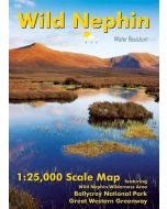 Wild Nephin 1:25,000Featuring Ballycroy National Park & Great Western Greenway£12.99
CME252
In Stock