We use cookies to make your experience better. To comply with the new e-Privacy directive, we need to ask for your consent to set the cookies. Learn more
Dolpo Circuit Map NE513
Dunai, Phoksumdo Lake, Shey Gompa
£17.99
In Stock
Usually dispatched within 24 hrs. Free delivery to UK for orders £25 and over
| Cordee Code: | CMW698 |
|---|---|
| Page Size: | 125 x 245 mm |
| Publisher: | Nepa Publications |
| ISBN13: | 9789937918749 |
| Scale: | 1:125,000 |
| Author: | Nepa Maps |
| Published Date: | October 2012 |
| Edition: | 2012 |
| Binding: | Sheet Map (folded) |
| Weight: | 80g |
| Product Type: | Map |
| Countries: | Nepal |

The Upper and Lower Dolpo Circuits in western Nepal presented on a map at 1:125,000 from Nepa Maps with coverage extending from the Shey Phoksundo National Park to Jumla. The two Dolpo Circuits, the Kagmara La trek and the Jumla to Juphal route are prominently highlighted. The map also indicates which sections of the marked routes are part of the Upper or the Lower Great Himalayan Trail (GHT). Contour lines are at 80m intervals. Latitude and longitude are shown by margin ticks at 5' intervals. The index list places, peaks, base camps and lakes. On the inside cover are stage-by-stage distances and timings for the main trekking routes.
Other titles of interest:
-

-
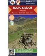 Dolpo amp Mugu 1150000 GHT trekking map NP109 dblsidedPhoksumdo - Chharka Bhot - Kanjirowa Himal (weather-proof)£19.99
CMW617
Temp Out Of Stock