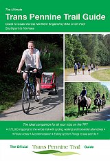
Ultimate Trans Pennine Trail Guide
Coast to Coast Across Northern England - bike or on foot
£9.95
|
|
An entirely new guide to the Trans Pennine Trail. The hugely popular 370 miles (595km) of trail across the north of England is a big favourite with walkers and cyclists, with many sections available for horse-riders and wheelchair users. The trail is suitable for users of all ages and abilities due to its easy gradients and traffic free conditions. This guide is packed with full colour maps, trail info and photos, making it perfect for planning and use along the way.
Plan a scenic walk or bike ride, perhaps through the Pennines themselves, with its many pretty villages, museums and other visitor attractions along the way, very often with the possibility of a train return. For weekend or longer breaks on the trail you can select something from the wide range of accommodation in the guide, from the simple to the stylish and the quirky to the budget. Or, plan your leisurely day out with the kids, maybe combining a canal side walk or ride with a visit to a stately home. There's also the ultimate challenge of a coast to coast walk or cycle ride stretching 215 miles (346km) from Southport to Hornsea. Whatever your choice, the Ultimate Trans Pennine Trail Guide can help.
This brand new guide features:
* Detailed full colour 1:75,000 mapping showing route options for cyclists, walkers and horse-riders.
* Street-level mapping for main towns and cities along the way, including: Southport, Liverpool, Widnes, Stockport, Penistone, Doncaster, Chesterfield, Sheffield, Leeds, Selby, Hull and Hornsea.
* Numerous colour images.
* Route navigation notes.
* Sleeping, eating and sightseeing suggestions cross-referenced to the mapping.
Part of the popular Ultimate Guide Series which includes the bestselling Ultimate C2C Guide.
Author Richard Peace has written and photographed more than 20 cycling titles as well as being a contributor to numerous cycling magazines and websites including Cycle (the official Cycle UK magazine), Bikeradar, Free-wheeling France and A to B transport magazine.
In Stock
Usually dispatched within 24 hrs. Free delivery to UK for orders £25 and over.
£9.95
Cordee Code: CCY121
Author: Richard Peace
No of Pages: 152
Page Size: 170 x 120 mm
ISBN 10: 1901464369
ISBN 13: 9781901464368
Publisher: Excellent Books
Published Date: March 2017
Edition: 1st ed, 2017
Binding: Spiral/Wirobound
Illustrations: full colour maps
Weight: 230g
|


 Accommodation Guides