Two Moors Way Map Booklet
£7.95
|
|
All the mapping you need to complete the Two Moors Way, Devon's coast to coast route between Wembury Bay and Lynmouth, including a section of the Erme-Plym Trail.
NOTE: An accompanying Cicerone guidebook - The Two Moors Way - describes the route south to north, with summary directions for walking north to south. It includes lots of other practical information and background notes on points of interest along the route, for those who prefer a written guide. The accompanying guidebook INCLUDES a copy of this map booklet.
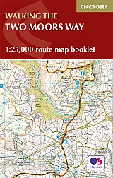
This booklet of Ordnance Survey 1:25,000 Explorer maps has been designed for convenient use on the trail. It shows the full and up-to-date line of the Two Moors Way, along with the relevant extract from the OS Explorer map legend. It is conveniently sized for slipping into a jacket pocket or top of a rucksack and comes in a clear PVC sleeve.
In Stock
Usually dispatched within 24 hrs. Free delivery to UK for orders £25 and over.
£7.95
Cordee Code: CP0228
Author: Sue Viccars
No of Pages: 48
Page Size: 106 x 166 mm
ISBN 10: 1786310074
ISBN 13: 9781786310071
Publisher: Cicerone Press
Published Date: February 2019
Edition: 1st ed, Feb 2019
Binding: Other
Illustrations: 1:25 000 mapping
Weight: 90g
|


 Accommodation Guides

